MAP OF THE SHITAYA TOKYO AREA
 Cookie preferences
Utilizamos Cookies propias y de terceros para recopilar información para mejorar nuestros servicios y para análisis de tus hábitos de navegación. Si continuas navegando, supone la aceptación de la instalación de las mismas. Puedes configurar tu navegador para impedir su instalación.
Required cookies
Always active
These cookies are strictly necessary for the operation of the site, you can disable them by changing the settings of your browser but you will not be able to use the site normally.
Cookies used
Functional cookies
These cookies provide necessary information to applications of the website itself or integrated by third parties, if you disable them you may find some problems in the operation of the page.
Cookies used
Performance cookies
These cookies are used to analyze the traffic and behavior of customers on the site, help us understand and understand how you interact with the site in order to improve performance.
Cookies used
Guided cookies
These cookies can be from the site itself or from third parties, they help us to create a profile of your interests and to offer you advertising aimed at your preferences and interests.
Cookies used
Se informa al usuario de que tiene la posibilidad de configurar su navegador de modo que se le informe de la recepción de cookies, pudiendo, si así lo desea, impedir que sean instaladas en su disco duro.
A continuación le proporcionamos los enlaces de diversos navegadores, a través de los cuales podrá realizar dicha configuración:
Firefox desde aquí: http://support.mozilla.org/es/kb/habilitar-y-deshabilitar-cookies-que-los-sitios-web
Chrome desde aquí: https://support.google.com/chrome/answer/95647?hl=es
Explorer desde aquí: https://support.microsoft.com/es-es/help/17442/windows-internet-explorer-delete-manage-cookies
Safari desde aquí: http://support.apple.com/kb/ph5042
Opera desde aquí:http://help.opera.com/Windows/11.50/es-ES/cookies.html
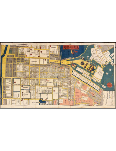
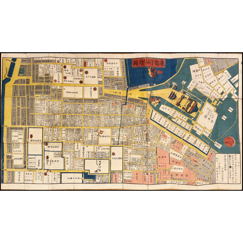
MAP OF THE SHITAYA TOKYO AREA
Subject: Antique cartography of the 19th century. Japan. Tokyo.
Publication: Edo period, Owariya Seishichi, 1857.
Description: Detailed map of the Shitaya area of Tokyo.
These maps include a legend delineating geographical and architectural features by color and shape: roads and bridges (yellow), rivers, lakes and ocean (blue), shrines and temples (red), fields and hills (green), and merchants' houses (gray). The noblest residences are indicated with a black circle, residences of higher rank with a black square. Residences of even higher distinction are marked with the emblem or coat of arms of the families. Surprisingly, almost all residences also include the name of the inhabitant's family.
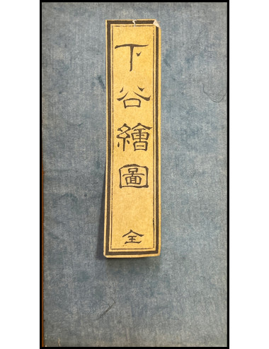
Dimensions: Map (49.5 x 90 cm). Folded (17 x 9 cm). Original covers in blue paper with shingles.
Technique: Xylography in color.
Conservation: Good condition, small wear and tear and xylophage spots.
IS2
MAP OF THE SHITAYA TOKYO AREA