 Cookie preferences
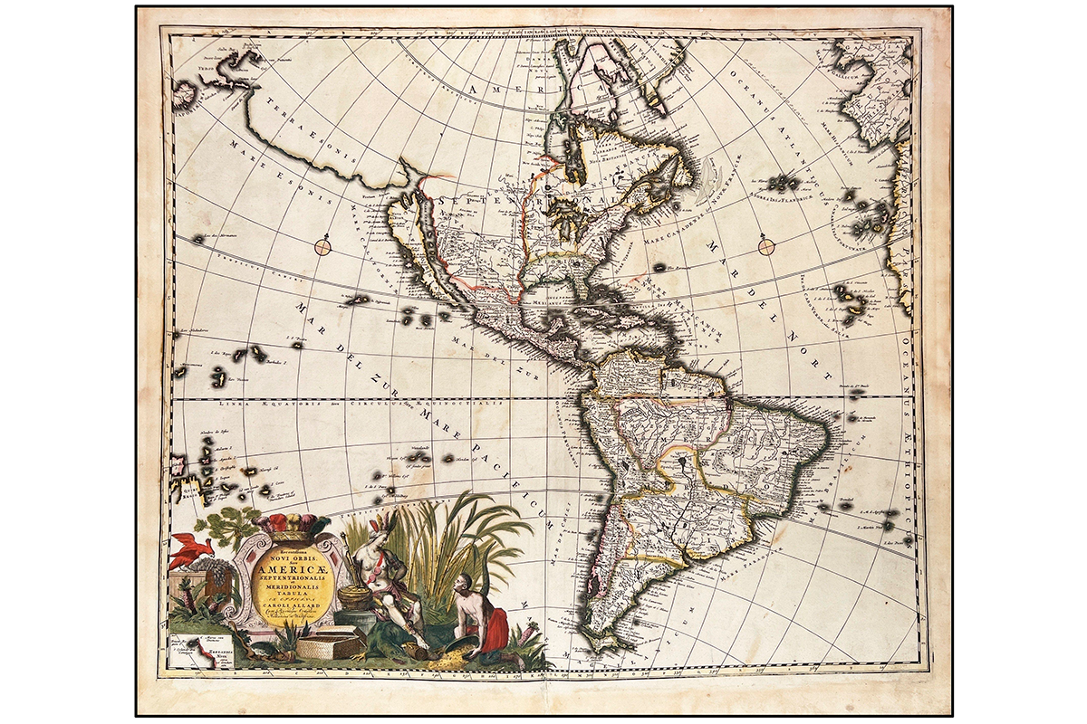
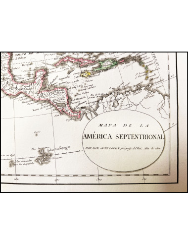
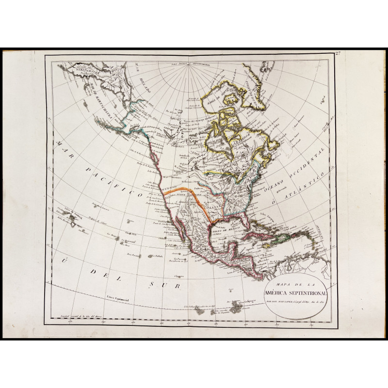
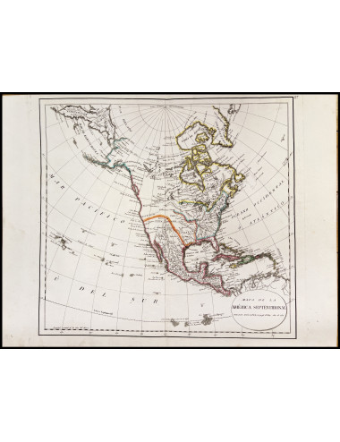
Subject: 19th Century Antique Cartography. North America.
Publication: Madrid, 1801.
Technique: Copperplate engraving, boundary lines colored with watercolor from the period.
Measurements: 38 x 41 cm (plate) 38.5 x 50 cm (paper)
Description: Meridian of origin: Hierro. - Graded margins. - Meridians and parallels drawn forming a grid. - Relief by profile mountains. - Hydrographic network. - Toponymy. - Political division differentiated by color line. - Coast marked with fine hatching.
López, Juan. Madrid, 13.I.1765 – 16.XII.1825. Royal geographer, cartographer, map editor and engraver, archivist of the Geographical Cabinet.
Juan López was baptized in the church of Santa Cruz in Madrid. He was the son of Tomás López de Vargas y Machuca and María Luisa Gosseaumé y Doré, and the elder brother of Tomás Mauricio. Both brothers, especially Juan, were educated to continue their father's cartographic work. Juan studied Grammar and Geography, and obtained a royal pension to train in Humanities and in Greek, English, French, and Italian languages. For two years he studied Mathematics with Antonio Rosell at San Isidro el Real, and the Monarch ordered him to apprentice with his father "in the geographical career." In 1780 he published his first cartographic works and signed as "pensioner of His Majesty." The following year he began to appear as an author alongside his father on some maps, and he joined the Royal Sevillian Academy of Belles Lettres as an honorary academician (October 26, 1781). By letter from the Marquis of Narros, secretary of the Royal Basque Society of Friends of the Country to his father (around 1784), in which he thanks him for the gift of his son's map of the island of Santo Domingo, it is known that he would be admitted as a member of that Society, in the professor class. In 1785 he joined the Royal Society of Friends of the Country of Asturias. From that year on, he and his father announced their works in printed catalogs, which were sometimes included at the end of their books: Catalog of the geographical works and maps made by Don Thomás López, Geographer of the domains of H.M. and by D. Juan his son, Pensioner of the King.
Product Details
MD-8764
Data sheet
- Product type
- Maps
- Author
- JUAN LOPEZ DE VARGAS
- Year
- Place
- Madrid
- Condition
- Perfect condition
- Artistic technique
- Engraving
Quick Compare
Product |
 JUAN LÓPEZ DE VARGAS - MAP OF NORTH AMERICA - 1801
|
 WILLEM BLAEU - VILLA NOVA DELL'ASTEGIANA (PIAMONTE) - 1726
|
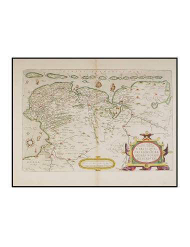 ABRAHAM ORTELIUS - MAPA DE FRISIA - 1579
|
Availability |
|
|
|
Price |
€300.00
|
€350.00
|
€350.00
|
Description |
MAPA DE LA AMÉRICA SEPTENTRIONAL POR DON JUAN LÓPEZ GEÓGRAFO DEL REY |
||
Product type |
Maps | Maps | Maps |
Author |
JUAN LOPEZ DE VARGAS | BLAEU, Willem Janszoon | ORTELIUS, Abraham |
Year |
1726 | 1579 | |
Place |
Madrid | ||
Printing / Plublisher |
|||
Condition |
Perfect condition | Perfect condition | Good condition |
Artistic technique |
Engraving | Engraving | Engraving |
Quick Compare
Product |
JUAN LÓPEZ DE VARGAS - MAP OF NORTH AMERICA - 1801
|
WILLEM BLAEU - VILLA NOVA DELL'ASTEGIANA (PIAMONTE) - 1726
|
ABRAHAM ORTELIUS - MAPA DE FRISIA - 1579
|
Availability |
|
|
|
Price |
€300.00
|
€350.00
|
€350.00
|
Description |
MAPA DE LA AMÉRICA SEPTENTRIONAL POR DON JUAN LÓPEZ GEÓGRAFO DEL REY |
||
Product type |
Maps | Maps | Maps |
Author |
JUAN LOPEZ DE VARGAS | BLAEU, Willem Janszoon | ORTELIUS, Abraham |
Year |
1726 | 1579 | |
Place |
Madrid | ||
Printing / Plublisher |
|||
Condition |
Perfect condition | Perfect condition | Good condition |
Artistic technique |
Engraving | Engraving | Engraving |
MAPA DE LA AMÉRICA SEPTENTRIONAL POR DON JUAN LÓPEZ GEÓGRAFO DEL REY